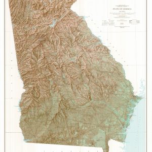
This map by the US Department of Geological Survey was first drawn in 1963. This 1970 exquisite edition uses shaded relief to portray the land which combines shading with elevation tints that portray landforms much more clearly than contour lines. These techniques and elevation colors make mountains, highlands and valleys immediately obvious. This map is…
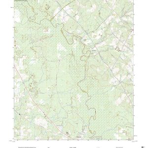
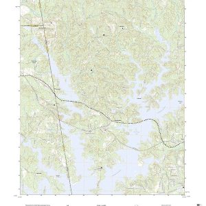
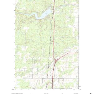
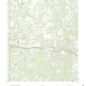
This is the current USGS topographic map for this quadrangle. Printed on waterproof, crease resistant paper, using HP fade resistant inks, this map comes rolled and shipped in a sturdy carboard tube. The map contains contour data, water features, roads and other features. Scale is 1:24,000. Printed size is 24 W x 29 H
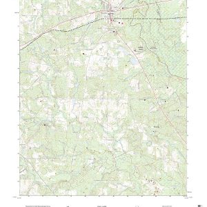
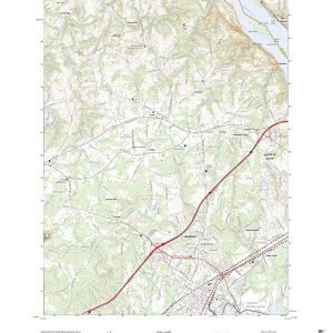
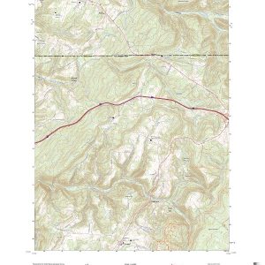
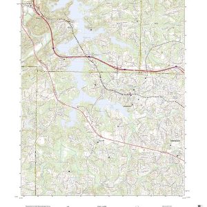
This is the current USGS topographic map for this quadrangle. Printed on waterproof, crease resistant paper, using HP fade resistant inks, this map comes rolled and shipped in a sturdy carboard tube. The map contains contour data, water features, roads and other features. Scale is 1:24,000. Printed size is 24 W x 29 H
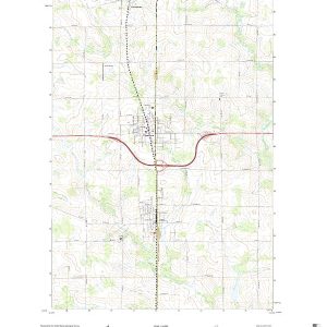
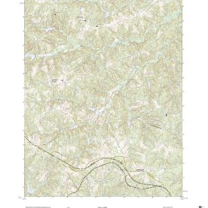
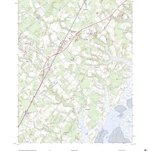
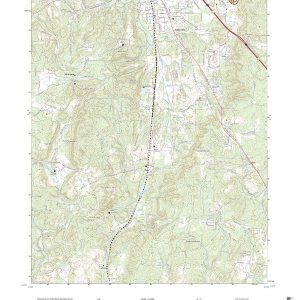
This is the current USGS topographic map for this quadrangle. Printed on waterproof, crease resistant paper, using HP fade resistant inks, this map comes rolled and shipped in a sturdy carboard tube. The map contains contour data, water features, roads and other features. Scale is 1:24,000. Printed size is 24 W x 29 H
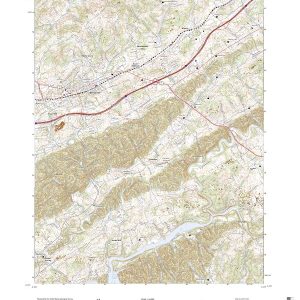
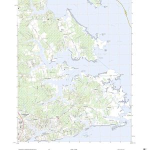
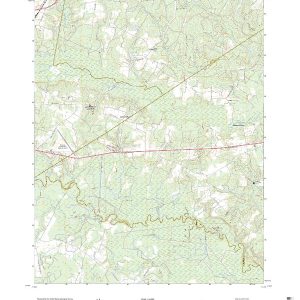
This is the current USGS topographic map for this quadrangle. Printed on waterproof, crease resistant paper, using HP fade resistant inks, this map comes rolled and shipped in a sturdy carboard tube. The map contains contour data, water features, roads and other features. Scale is 1:24,000. Printed size is 24 W x 29 H
This is the current USGS topographic map for this quadrangle. Printed on waterproof, crease resistant paper, using HP fade resistant inks, this map comes rolled and shipped in a sturdy carboard tube. The map contains contour data, water features, roads and other features. Scale is 1:24,000. Printed size is 24 W x 29 H
This is the current USGS topographic map for this quadrangle. Printed on waterproof, crease resistant paper, using HP fade resistant inks, this map comes rolled and shipped in a sturdy carboard tube. The map contains contour data, water features, roads and other features. Scale is 1:24,000. Printed size is 24 W x 29 H
This is the current USGS topographic map for this quadrangle. Printed on waterproof, crease resistant paper, using HP fade resistant inks, this map comes rolled and shipped in a sturdy carboard tube. The map contains contour data, water features, roads and other features. Scale is 1:24,000. Printed size is 24 W x 29 H
This is the current USGS topographic map for this quadrangle. Printed on waterproof, crease resistant paper, using HP fade resistant inks, this map comes rolled and shipped in a sturdy carboard tube. The map contains contour data, water features, roads and other features. Scale is 1:24,000. Printed size is 24 W x 29 H
This is the current USGS topographic map for this quadrangle. Printed on waterproof, crease resistant paper, using HP fade resistant inks, this map comes rolled and shipped in a sturdy carboard tube. The map contains contour data, water features, roads and other features. Scale is 1:24,000. Printed size is 24 W x 29 H
This is the current USGS topographic map for this quadrangle. Printed on waterproof, crease resistant paper, using HP fade resistant inks, this map comes rolled and shipped in a sturdy carboard tube. The map contains contour data, water features, roads and other features. Scale is 1:24,000. Printed size is 24 W x 29 H
This is the current USGS topographic map for this quadrangle. Printed on waterproof, crease resistant paper, using HP fade resistant inks, this map comes rolled and shipped in a sturdy carboard tube. The map contains contour data, water features, roads and other features. Scale is 1:24,000. Printed size is 24 W x 29 H
This is the current USGS topographic map for this quadrangle. Printed on waterproof, crease resistant paper, using HP fade resistant inks, this map comes rolled and shipped in a sturdy carboard tube. The map contains contour data, water features, roads and other features. Scale is 1:24,000. Printed size is 24 W x 29 H
This is the current USGS topographic map for this quadrangle. Printed on waterproof, crease resistant paper, using HP fade resistant inks, this map comes rolled and shipped in a sturdy carboard tube. The map contains contour data, water features, roads and other features. Scale is 1:24,000. Printed size is 24 W x 29 H
This is the current USGS topographic map for this quadrangle. Printed on waterproof, crease resistant paper, using HP fade resistant inks, this map comes rolled and shipped in a sturdy carboard tube. The map contains contour data, water features, roads and other features. Scale is 1:24,000. Printed size is 24 W x 29 H
This is the current USGS topographic map for this quadrangle. Printed on waterproof, crease resistant paper, using HP fade resistant inks, this map comes rolled and shipped in a sturdy carboard tube. The map contains contour data, water features, roads and other features. Scale is 1:24,000. Printed size is 24 W x 29 H